
PDM Castanheira de Pêra, Municipal Master Plan of Castanheira de Pêra
In Castanheira de Pêra, about 5% of the territory is urban land under the current PDM. See what you can build, where, and the rural zones with the most reclassification potential.
PDM changes
Every amendment to municipal master plans, straight from the national registry (SNIT). Pick a district, municipality or parish on the map to scope this list; click a row to see it on the map.
| Municipality | District | Change | Publication | Date |
|---|---|---|---|---|
| Loading… | ||||
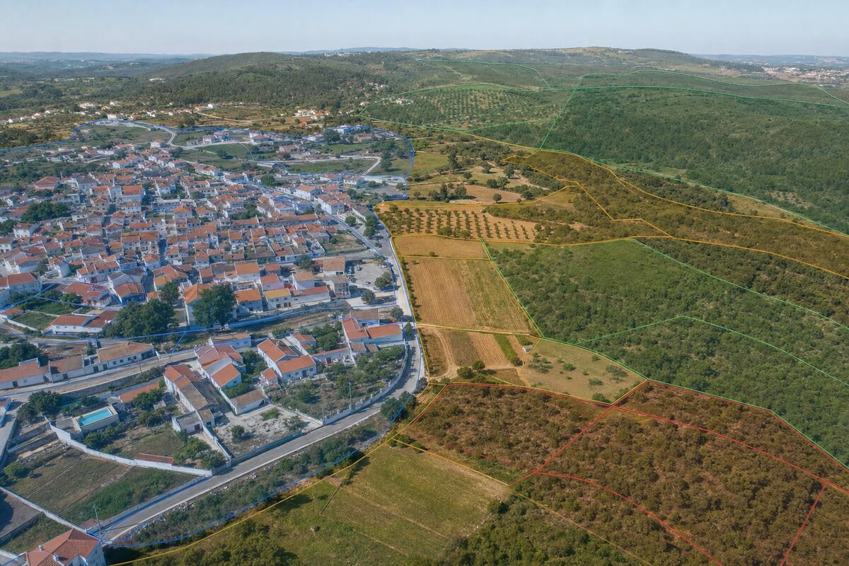
Where can you build in Castanheira de Pêra?
In Castanheira de Pêra, about 5% of the territory is classified as urban land under the current PDM. That is where construction is generally allowed. The rest is rural land, where building is limited to the plan's exceptions. Castanheira de Pêra's Municipal Master Plan organises the area into 214 zones and has been amended 10 times, most recently on 6 March 2026.
For rural plots next to already-urbanised areas, Portugal's Lei dos Solos opened the door to reclassification as urban land. In Castanheira de Pêra, explorador.pt identifies 1 zones with this potential. Use the zoning map below to locate your plot and confirm its classification.
Reclassification opportunities
1 rural zones here are scored for reclassification potential.
The ranked list, the map layer, the signals behind each score and the AI evaluation are part of Radar.
See RadarMedian price per m², typology breakdown, parish comparison and rental yield.
Other municipalities in Leiria
- Alcobaça13.9% urban · 1429 zones
- Alvaiázere6.7% urban · 422 zones
- Ansião11.5% urban · 2075 zones
- Batalha16.3% urban · 481 zones
- Bombarral9.8% urban · 522 zones
- Caldas da Rainha18.3% urban · 901 zones
- Figueiró dos Vinhos2.9% urban · 2063 zones
- Leiria25.1% urban · 1801 zones
- Marinha Grande19.4% urban · 1562 zones
- Nazaré13.3% urban · 101 zones
- Óbidos10% urban · 381 zones
- Pedrógão Grande5.4% urban · 1748 zones
- Peniche24.7% urban · 189 zones
- Pombal12.6% urban · 3876 zones
- Porto de Mós12.3% urban · 884 zones