
PDM Estremoz, Municipal Master Plan of Estremoz
In Estremoz, about 1% of the territory is urban land under the current PDM. See what you can build, where, and the rural zones with the most reclassification potential.
PDM changes
Every amendment to municipal master plans, straight from the national registry (SNIT). Pick a district, municipality or parish on the map to scope this list; click a row to see it on the map.
| Municipality | District | Change | Publication | Date |
|---|---|---|---|---|
| Loading… | ||||
Status of the PDM of Estremoz
PDM of Estremoz in force in 2026: Revisão published as AVISO 10541/2015 on 16 September 2015.
- Plan in force
- Municipal Master Plan of Estremoz (SNIT instrument no. 2764) Official register
- Publication
- Revisão, AVISO 10541/2015, 16 September 2015 Diário da República (PDF)
- Latest amendment
- 1ª Alteração, DELIB 1591/2025, 29 December 2025 Diário da República (PDF)
- Amendments
- 8 acts published in total, 5 under the plan in force
How to confirm a revision or amendment
A revision or amendment only takes effect when it is published in the Diário da República. Check the PDM page of the Câmara Municipal de Estremoz, which announces procedures under way, and the SNIT register of the DGT, which lists every published act. The PCGT platform publishes the procedures in progress.
Source: SNIT register (DGT), synchronised on 25 August 2026. Acts published after that date may not appear yet.
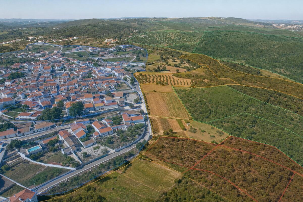
Where can you build in Estremoz?
In Estremoz, about 1% of the territory is classified as urban land under the current PDM. That is where construction is generally allowed. The rest is rural land, where building is limited to the plan's exceptions. Estremoz's Municipal Master Plan organises the area into 1717 zones and has been amended 8 times, most recently on 29 December 2025.
For rural plots next to already-urbanised areas, Portugal's Lei dos Solos opened the door to reclassification as urban land. In Estremoz, explorador.pt identifies 44 zones with this potential. Use the zoning map below to locate your plot and confirm its classification.
Land categories in Estremoz
The PDM of Estremoz classifies 51 380 ha: 608 ha of urban land (1%) and 50 772 ha of rural land (99%). Each class is split into categories that set what can be built. The ones with the most area:
| Class | Category | Hectares | Share |
|---|---|---|---|
| Solo Rústico | Espaço Florestal | 32 574 | 63% |
| Solo Rústico | Espaço Agrícola | 14 363 | 28% |
| Solo Rústico | Espaço Cultural | 1726 | 3% |
| Solo Rústico | Espaço Natural e Paisagístico | 1179 | 2% |
| Solo Rústico | Espaço de Exploração de Recursos Energéticos e Geológicos | 409 | <1% |
| Solo Rústico | Área de Edificação Dispersa | 364 | <1% |
| Solo Urbano | Espaço Habitacional | 234 | <1% |
| Solo Urbano | Espaço de Atividades Económicas | 141 | <1% |
| Other categories (6) | 389 | <1% |
Shares of the area classified by the PDM, from the CRUS dataset of the DGT. Water bodies and roads the plan leaves unclassified are not counted.
Constraints in Estremoz: RAN and REN
Besides the land classification, the PDM of Estremoz is subject to public easements and restrictions. According to the DGT maps, about 19% of the municipality is in the National Agricultural Reserve (RAN) and 41% is in the National Ecological Reserve (REN).
The RAN protects the soils with the highest agricultural capability. Building in RAN requires a favourable opinion from the regional agriculture authority and, as a rule, is only admitted for agricultural uses or works of public interest.
The REN protects sensitive areas such as flood plains, the coastal strip, unstable slopes and aquifer recharge zones. Building in REN is forbidden, except for the uses the law allows, which depend on prior notice to or authorisation from the regional CCDR.
These shares come from the RAN and REN maps published by the DGT and can overlap urban land. Always confirm a specific plot on the PDM constraints map and on the map above.
Reclassification opportunities
44 rural zones here are scored for reclassification potential.
The ranked list, the map layer, the signals behind each score and the AI evaluation are part of Radar.
See RadarRegulation and official documents
The binding text is the regulation published in the Diário da República. The zoning and constraints maps (planta de ordenamento, planta de condicionantes) are consulted on the municipal geoportal, and the full record of the plan and its amendments is kept by the DGT.
- PDM regulation of Estremoz, Diário da RepúblicaRevisão · AVISO 10541/2015
- Official register, SNIT (DGT)Instrument no. 2764
- Municipal council websitecm-estremoz.pt
Median price per m², typology breakdown, parish comparison and rental yield.
Other municipalities in Évora
- Alandroal1.1% urban · 1407 zones
- Arraiolos1% urban · 891 zones
- Borba3.1% urban · 346 zones
- Évora1.5% urban · 759 zones
- Montemor-o-Novo0.6% urban · 1707 zones
- Mora0.7% urban · 448 zones
- Mourão0.8% urban · 124 zones
- Portel0.6% urban · 204 zones
- Redondo1.1% urban · 731 zones
- Reguengos de Monsaraz1.4% urban · 425 zones
- Vendas Novas6.5% urban · 364 zones
- Viana do Alentejo0.7% urban · 165 zones
- Vila Viçosa2.6% urban · 405 zones